Chasing the Blues (June 28, 2014)

Ah, Oregon in June ... you have not failed me yet.  Over the past six summers, I have experienced rides in June in Oregon ... and without fail ... rain.

That fact leads me to think that maybe I am not the brightest light in the marquee, or that due to the joy of the rides (after the rains cease) causes me to forget how uncomfortable riding in the rain can be.  The joys expressed by Gene Kelly (whilst singing and dancing in the Paris rain) are not shared by me.

Three days of not enjoying sporadic rain riding north was enough for me.  Coming into Seaside, OR, one of the first things one sees is this blue Motel 6 sign. Having mentioned my dislike for riding in the rain, I should point out that one thing I like even less is purposely camping in the rain.  I had planned on riding an additional 16 miles to the Fort Stevens State Park campground.  Plans be damned ... make a hard right-hand turn into the Motel 6 and enjoy a hot shower and a warm room, then ride on to Fort Stevens on Friday.

Wake up Friday morning to a downpour ... check the weather predictions for the coming day ... extend the stay for another day.  Gray day in the weather leads to the blues in my mental outlook.  Not having a book that has captured my attention, and not being a person who can watch daytime TV crap, I spent the day moping around and taking walks into Seaside (and the ongoing rain).  Makes for a long day of doing little.

Today looks to be less rainy, and the storms are supposed to move inland this evening, so I will be heading for Fort Stevens/Astoria later this morning.   One factor in my blue mood is that I am just kind of killing time prior to getting to Portland next Thursday.  If there is a specific goal and a laid out path of travel then riding in the rain is bearable ... but if I feel like I am just kind of putzing around, then it makes little sense to be out in the wet and cold.  

Starting tomorrow, the skys should be blue ... and that should take care of my blues.

Gray Days (June 26, 2014)

After having spent a couple of wonderful days in Eugene, I headed for the Coast anticipating experiencing some of that scenic beauty one associates with the Oregon Coast of blue skys, blue ocean, and green wooded areas ... beauty that is stunning no matter how many times one travels the Coast. 

As it turns out, Mother Nature has decided to coat the entire Coast in an overcast shade of gray.  Cold and wet is the ongoing theme of this part of the ride ... cold and wet.

One aspect of riding the Coast that I was looking forward to is seeing and meeting other touring cyclist.  This is being realized, and it is a joy to see the exuberance and wide-eyed smiles of these (for the most part neophytes to touring) road warriors, even though the road (and the cyclist) is cold and wet.  For the majority of the twenty or so riders I have talked with, the tours are two to three days old having started in Astoria, OR.  Some are going across country, most down the coast.  New bikes, new panniers, new joy.  I love seeing so many folks out doing what I love.

As is usual with me. my planned route is once again experiencing change.  I had planned to head north from Astoria up and over the Olympic Peninsula, then catch Amtrak back to Portland for the music festival.  After looking more indepth at this plan, I came to realize that I was attempting to pack alot of miles into a small amount of time ... long days and tired legs just don't seem to be working for me these days.  So I have decided to slow it all down, take a few days off in Astoria to absorb Lewis and Clark history, then ride up into southwestern Washington and then eastward toward Portland.  Simplifies and eases the approach to Portland.

As is typical for me when approaching the end point of a long ride, I am mentally back in Tucson ... but given the grayness of the road these days, Tucson is a nice place to be (heat and all).  Looking forward to getting home.

Incredible Beauty (June 20, 2014)

The beauty of Central Oregon is quite an  eye opener for me ... every time I ride through this area I am once again reminded that there is much more to life then the beauty of the Sonoran Desert.

The starkness of the snow covered mountains against the green of fields and forests just brings a sense of awe.  I can not, however, say that the bleakness atop McKenzie Pass would fall into the category of "beautiful" ... surreal or unreal, maybe, but not in any fashion attractive.

Upon leaving the comfort of Bill's home south of Bend, I took a leisurely ride into, and around Bend, then camped at Tumalo State Park (about 7 miles north of Bend).  The city of Bend is quite nice and a cyclist's dream.  I am not an off-road cyclist, but I read that there are any number of great off-road trails in this area.  As for road cyclist ... miles and miles of beautifully paved and meandering roads to the west and south of Bend.  The thing that is surprising to me is that there does not seem to be much in the way of infrastructure for cyclist in the city itself.  There are a number of nice bike lanes, but no sense of routes.  There are bike paths shown along the river that runs through Bend, but they sporadically change from pavement to gravel (several inches deep).  I stopped at bike shops, R.E.I. and information booths ... "No, no city maps showing suggested routes through town ... good idea, though."  Anyway, I had an easy day of it, and relaxed out at the State Park in the Hiker/Biker campground.  Met a couple of young guys from Vancouver, B.C. who were doing a ride down the coast, over to Crater Lake, then over to Eugene to  take the train back north.

The next day was an easy day of 17 miles to Sisters ... to the City Campground.   I studied the "Fee Board" to see costs and such.  Tent sites: $15 ... Full service RV sites:  $35 (senior discount to $30) ... no service RV sites: $15 (senior discount to $10).  No map of where anything is located, but there was a note to call City Hall with questions.  Sisters is a very small town, so I rode over to the City Hall with  the question "How come no senior discount to the tent sites?" angrily brewing in my mind. I was feeling quite discriminated against!!  As it turns out, they now offer a hiker/biker area ($5), so I quickly forgot about the "Tent site/no senior discount" inequity ... let someone else fight that fight.

McKenzie Pass is directly west of Sisters, and consists of about a 12 mile climb (2100 feet or so), followed by about 3 or 4 miles through the lava river areas, then about 20 miles of what is now my most favorite ride of all time.   The lava river area is stark ... black with the occasional white of what little snow remaining (with the exception of the snow capped mountains) ... beautiful in it's own way, but not pleasing to the eye.  The ride down, however, is amazing. 

Two summers ago I rode this same road, but was heading in the opposite direction.  It was raining and snowing and cold and quite uncomfortable.  Quite uncomfortable.  What a difference blue skies and relative warmth can make.  The road was very smooth and for the most part quite gentle as to turns ... but it was downhill all the way.  The forest was as green as I have experienced, and the low lying ferns carpeted the forest floor with a lushness that was very pleasing to the eye.  Wonderful riding experience.

Today I am heading to Eugene, then Sunday heading to the coast.  Still unsure of route upon reaching Astoria, but feeling good.

Life  is good when surrounded by beauty.

Crater Lake (June 13, 2013)

This is the one view of Crater Lake that I got, and it kind of reminds me of Bar Harbor.

That was an inside joke that probably only Kim will get.

Alex was nice enough to show me pictures he had taken the day before ... deep deep blue water and sky.  So not only was my ride hard and very unsettling due to the blizzard, but I also missed an incredibly beautiful experience.

Think I may steal some of Alex's pictures and claim them as my own.

Crater Lake ... right up their with riding the C&O Canal.

New Friends ... Old Friend (June 16, 2014)

I have said it quite often in my postings regarding this torturous, mountainous, climbinous (I made that one up) ride, that having met Sarah and Alex has made all of the difference between a not-so-great experience and a most enjoyable (discounting the climbing) adventure.

Having arranged to meet them and ride into Bend with them has made me extremely happy and grateful ... friends for life formed over a very short time.  Great people.

While they were going to a State Park beyond Bend, I was heading to a turnoff from the highway, about 20 miles south of Bend. that would lead me to my long time friend, Bill Burk.  When we reached Vandervert Road (I might add that Sarah had asked the name of the road to make sure I was not in my usual "day dream" mode and miss the turn), we stopped and hugged all around, said our good byes ... can't speak for them, but I pedaled away with a strange mixture of sadness (due to parting ways) and joy (from having met them).

After making the turn, I rode to Bill's new house ... and what an amazingly nice place it is.  Bill and I have been friends since the early 1970s, and as with such long time friends, there is much joy in reconnecting ... it seems like conversations start up where they left off previously.  Bill has been most gracious to allow me to stay with him for a few days of R&R, all the while giving me tours of the Bend area.  Bend is a place to come back to visit again.

I will be heading on up to Sisters, OR tomorrow, then on to Eugene and the Oregon Coast.  The stop here in Bend has been a rejuvenating time.  I have looked at possible routes for the coming weeks prior to getting to Portland on July 4 ... may even make it up to Seattle.

Making it to Seattle would allow me to get together with my new old friends Sarah and Alex once again.

Goes without saying ... friends make life good.


Idle Threats from Body Parts (June 14, 2014)

There I was just minding my own business when wham ... snow blizzard!

Since leaving Ashland after a day of R&R, several different experiences have occurred.  On Wednesday (the 11th), after once again bidding adieu to my on-again-off-again traveling partners the prior day, I  rested at the top of the Dead Indians Memorial Road Pass (the initial 14 mile climb/miles of the day), and knew that I had made the right decision to not head out on this route yesterday with Sarah and Alex ... no way in hell I could have made it to the pass due to the ride on I-5.  Even after the day of rest my legs were warning me that they may well self-amputate unless I slow things down.  Being a wise person, and recognizing how often I use my legs, I decided to heed my legs' warning and take it somewhat easier.  The ensuing miles were enjoyable in that they were on a little traveled road (by cars) and were primarily down hill.  As I am want to do in such cases, my mind began to wander ... to the point that I missed a turn and added 10 miles to the day's ride.  Sadly, this is not uncommon; as a student Iwas often moved away from the window wall

After a restive evening camping, the next day I headed on on even a less trafficked road to the town of Prospect, OR.  Ann Marie and Gus (Last-name-not-recognizable-due-to-my-hearing-loss) own a beautiful ranch out side of Prospect.  Some time back Ann Marie was talking with a touring cyclist who mentioned that there is a lack of camping sites in the area.  So, Ann Marie and Gus have set aside a beautiful park-like area for we touring cyclist to camp.  Very nice people ... very generous to say the least.  Sometimes I lump all "farm/rancher" folks into a distorted image of rural folks of less than urban qualities.   How wrong I usually am.  Ann Marie, who is 66 years old and was a competitive swimmer in her younger years,  has been training and attending seminars in the San Francisco area to become certified as a swimming coach for top level competitive triathletes.  As I say, very nice people. 

The ride into Prospect had been a most beautiful day, and I was thinking that the following day's ride up to Crater Lake would be similar, and looking at the weather projections the "weatherman" seemed to agree.  Only a 20% chance of rain.  All seemed promising for a nice ride up to the Lake, followed by an easy day of riding the rim road around the Lake, then followed by another easy 35 mile day down towards Bend, OR.  Ah, indeed, I was going to treat my legs well ...

... Well, seems 20% chance of rain means that the rain will fall only on the roadway, all 30 miles up to the Crater Lake campground.  All the way ... up.  Cold and wet ... all the way ... up.  I arrived at the campground/restaurant area and asked about the projected weather for the coming night and following day .... cold (as in 30s and 40s) and wet (as in rain/sleet/snow).  I decided that it did not make much sense to subject myself to such conditions, so decided to head on out of the Park.  Problem is (was) that from where I was to the top of the Crater Lake Pass I had to climb about 1500 feet ... and it was nasty cold where I was!  Being subject to making decisions deserving of additional and more well informed thought, I mistakenly headed on.

The climb was not so bad, but then it started to drizzle ... then it started to rain, ... then it started to sleet ... then it started to snow (nice soft individually designed show flakes) ,,, then the wind picked up and the soft snow flakes became individual ice bullets to my face.   Visibility dropped  to about 20 yards.  And the climb continued ... and continued.  Fingers, toes, ears and nose ... froze.

Sometimes we all find ourselves in a situation where the thought may be, "This really is not something or somewhere I should be or be doing".  Another way of saying this kind of thought is, "Holy shit, what have I gotten myself into??"  No turning around, so forge ahead.  Eventually, and successfully, I reached the pass and descended down to a snowless area with the above mentioned body parts slowly thawing.  Much relief.

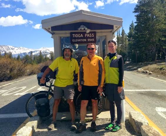
The remaining ride to my projected overnight (motel) was downhill, so the riding was much easier and much more relaxing (but then facing a firing squad may be more relaxing than what I had experienced up at Crater Lake).  As I was enjoying the ride, I came upon one of  the roadside "summit signs" that we have been experiencing over the past 1200 miles ... and to my joy, I espied a note left  by Sarah and Alex.  While my heart was being filled with joy reading the note, I realized that they had left it just an hour and half earlier (I thought it was from the previous day).  When I reached the motel that was fortunately located at about the same spot that my body quit on me, I sent a text to Sarah asking where they were that eventing ... 10 miles down the road closer to Bend.  We decided I would ride the 10 miles to meet them in the morning, then we would do our "swan song ride" to Bend together,  Ah, the joy. 

So I spent the evening in a very inexpensive motel celebrating the coming day's reunion and having successfully stared death in the face and slept like a baby. 

So much for respecting the threats from my legs. 

Massive (June 10, 2014)

Several days ago after exiting Lassen National Park, after having spent several weeks riding through beautiful forested areas, I was riding through an area that had recently been devastated by a forest fire.  The feeling was that I had passed from green to gray.  My thoughts were centered on how sudden beauty can change to drab ... was thinking how mundane the landscape had become.  After leaving Lassen National Park I felt I had experienced the ultimate in snow covered mountains.

For no particular reason, I glanced to the left and had my breath taken away by the shear size of Mt. Shasta ... a huge presence even though I was about 70 miles away.  Lassen Peak tops out at 10,457' ... Mt. Shasta at 14,179'.  Shasta is the "before" picture to Lassen's "after".  Lassen Peak, along with other adjacent peaks, is what remains of a massive volcano, called either Brokeoff Volcano or Mount Tehama, which erupted hundreds of thousands of years ago.  Looking at Mt. Shasta, I could only wonder what it would be like to experience the kind of devastation a similar eruption would create.

The next day I rode to the base of Mt. Shasta.  Unfortunately, there was a considerable amount of smoke in the air due to a forest fire somewhere upwind, so the mountain was somewhat blocked from view.  Experiencing the effects of viewing such beauty, not only of Mt. Shasta, but also of the forests of Northern California, one becomes most humble.

As mentioned in previous posts, I had experienced great joy in traveling with Sarah and Alex, so I became determined to catch up with them.  The 73 mile ride to Lassen was extremely tiring; the 84 mile ride to Mt. Shasta was almost debilitating.  But the 68 mile ride from Mt. Shasta to Ashland almost did me in.

Sarah had sent me a text indicating that they were in Ashland, and intended to take a rest day.  I headed out from Mt. Shasta feeling quite good and enjoying the first 20 miles or so of flat riding ... unheard of on this trip.  As I approached the first minor climb I noticed a slight headwind.  No problem, I had enough water to get me to Hornbrook where there was, according to my map, a restaurant where I could fill my water bottles and get some food into my system for the massive climb on I-5.  As I continued on the minor up and down climbs/descents, the wind got stronger and I got weaker (the past several hard days were catching up to me).  Finally I reached Hornbrook, ready for some food and the much needed refill of the water bottles ... too bad, so sad ... the restaurant had gone out of business and I did not see any stores along the route.  I figured that there might be a gas station at the interstate ... too bad, so sad.

So there I was, entering I-5 with about 13 miles of climbing (of the 20 miles remaining to get to Ashland) with very little water and no recently consumed food in my system ... and the wind was getting stronger.  To suggest that I was concerned would be an understatement.  I knew that if worst came to worse, I could always beg water or a ride from passing motorist.  After about 5 miles of climbing, I saw a liquor store on the other side of the interstate, but I had already passed the ramps to get to the store.  So there I went loping across both northbound and southbound lanes, plus scaling a barbwire fence, getting water, and returning across the obstacle course ... all the while thinking that maybe this is kind of crazy for a 65 year-old to be doing.

Not a lot of fun to be had on this day of riding ... other than when reaching the summit, I was ecstatic to see a sign regarding the impending downhill.  The usual sign (semi truck on a right triangle) was replaced by a very large sign with very large lettering warning drivers of the extremely steep and dangerous downhill.  The sign was not wrong, but where others may have felt fear, I felt unbridled joy.

I flew down that massive hill and found my way to the motel where Alex had booked a room.  I was exhausted and quickly found my way into my room, showered and met Alex for some chat time in comfortable chairs (as opposed to picnic tables).  I had caught up to them, my objective met ... but my body was pretty well destroyed.  I told Alex I would let them know in the morning if I would be riding out of town with them or taking a rest day here in Ashland.  Upon waking, I knew I was not heading out of town.

So I have taken a rest day here in Ashland, but have re-lost contact with Sarah and Alex.  Massive disappointment (not to be riding with them), but massive relief (body-wise).  I will be taking the rest of this trek in shorter sections.

I think my body thanks me ... massively.

Meditation Video ... (June 10, 2014)

... For those in a hurry

Friends in High Places (June 9, 2014)

Sarah, Alex and I had shared the sometimes agony and the joy of having passed over the 9945' Tioga Pass exiting Yosemite National Park, so at a later Pass (of roughly 4500') I left a note on the sign post stating "Big Deal"!

After my short riding day into South Lake Tahoe, and Sarah and Alex's same day longer ride to Truckee, they have been bringing friendship and joy into my days' rides by leaving notes taped to "summit" signs ... and in this case, a Pacific Crest Trail (hiking) sign.  I have been riding about a day behind Sarah and Alex, and the friendship exhibited by their leaving notes has brought happiness into my heart ... or it could be that they used the leaving of notes as a means of taking a breather at the end of long climbs.  Regardless of the motive, the notes are greatly appreciated.

Since leaving South Lake Tahoe, I have been putting in sizable mileage days in the hopes of reconnecting with Sarah and Alex ... they in turn have been putting in equally sizable mileage days in order to meet pre-arranged dates for meeting friends at specific locations (or possibly to avoid my reconnecting ...).  My days have been, from Tahoe, 43 miles to Truckee, 73 miles to Quincy, 74 miles to Lassen National Park, 50 miles to a RV Park (somewhere out in the middle of nowhere), then 83 miles to Weed (just north of Mt. Shasta).  In lieu of giving miles, I really should list the number of climbs (with summit signs gratefully adorned with notes), but simple numbers would not convey the sometimes agony of reaching that wonderful "6% slope (down) for next 6 miles" sign.  Painful.

For the most part, the terrain and flora are similar to the areas around Flagstaff, AZ, or upper reaches of the Mt. Lemmon sky island.

Again, there have been many, many, many climbs in the past several days, but the climb into Lassen National Park was probably the most notable.  At mile 66 of the day's ride, the road turned upward (one more time).  It was getting late in the afternoon, and I knew I was facing a seven mile climb to get to the Park Entry Gate ... seven miles at 3 to 4 MPH.  The map indicated a restaurant at the Park Visitor Center, so I used that as motivation to put in  the miles.  At mile 3 of the climb, there is one of those signs with a downward facing semi truck on the hypotenuse of a right triangle ... glorious steep downhill!!  Unfortunately the turn-off to the park was directly after the the sign's location.  Anyway, four more miles to the oft repeated mantra of my food related motivation ... big juicy cheeseburger, big pile of french fries, a couple of very cold bottles of beer, and a large helping of soft-serve ice cream.  Say that over and over and over again.

So after the seven miles of climbing I arrive at the Park Entry, which consists of a large welcome sign ... said Visitor Center was another 1.4 miles (up, naturally).  Finally, I pull up to the Visitor Center at about 6:15 .... and the food service had every one of my hoped for items of my motivational meal ... unfortunately, they close at 5:00!  So I quickly setup my tent, cooked my miserable dinner, climbed into the ol' sleeping bag around 8:00 ... and awakened at 6:00 the next morning.  To say I was tired after the riding is an understatement ... guys my age typically need to get up at least once during the night to empty the bladder ... either I was extremely tired or extremely dehydrated.  Either way, the full night of sleep was greatly appreciate. The riding has been hard, but beautiful.  Today I head to Ashland, OR ... Sarah and Alex are taking a day of rest to enjoy some of the Shakespeare Festival, so I will be reconnecting with them which makes me happy.

There are so many things I think about while riding that should be included in this journal, but due to the lack of wifi and the general lack to energy at day's end most of the thoughts go away.  One thought that sticks with me is to wish Bob Rogers a Happy Birthday ... the man just turned 70 and can outride most people I know ... inspiration, for sure.  Happy Birthday, Bob.

Ashland awaits ... time to load the bike and start riding.  The ever genteel and refined Sarah sent me a text yesterday describing the major climb between Mt. Shasta and Ashland ... I won't use the words she offered up, but the initials are "M.F.!!!!!!

More to come (June 8, 2014)

Very sporadic wifi signals of late ... but several days of interesting touring have passed since leaving Lake Tahoe.  Will be reaching Mt. Shasta tomorrow, and have booked a motel room, so will be able to (hopefully) get up to date on my travels.

One is the Loneliest Number (June 4, 2014)

Guess Three Dog Night had it right, one is the loneliest number.

For the last two weeks, Sarah, Alex and I have been enjoying traveling through some amazingly beautiful country.  We have climbed some huge uphills and descended some huge downhills.  We have shared stories and laughs at the various campsites.  Good people, those two.

Alas, yesterday we parted ways as I felt the need to take a short ride into South Lake Tahoe, and they proceeded on to Truckee.  I had some bike maintenance issues (new chain and rotating tires ... had a slight mishap two days ago and tore a small hole in the sidewall of the rear tire).  Plus, I needed to get a haircut before the hair police came along and dragged me away.  Plus, my legs were feeling the rides (meaning climbs) from the past few days.  I had a very productive day yesterday, and enjoyed the beauty of South Lake Tahoe.

Speaking of beauty, the adjacent picture was taken just south of Lake Tahoe, just prior to a wonderful 6 mile, 6% downhill into the Tahoe Basin (Hwy 89).  Beauty comes in many forms ... advice from friends can also be quite beautiful.  One of the major climbs we were facing after leaving Yosemite was Monitor Pass (@ 8314').  Prior to leaving Tucson, Melinda Corell mentioned that she and Steve used to ride all of the roads around Reno and Tahoe, so I sent her a query as to alternate routes (so as to avoid Monitor Pass).  Steve responded with several options ... we opted for the route with the least climbing (but as it turned out, the most headwind).  The advice was greatly appreciated.

We ended that day's ride at a RV park in Hope Valley.  The other night we stayed at a wonderful RV park in Lee Vining ... the Hope Valley park was at the other end of the spectrum.  Alex referred to the shower/bathroom as "rustic".  Not too sure about that as I always thought that "charm" was an key element in "rustic".  As it turned out, the facilities were okay, but at the bottom of a huge hill.  We survived, but the morning was very cold.

So, back to riding alone ... Sarah and Alex have some specific locations/dates to meet, so they are charging ahead.  I am missing them immensely already.  There is an outside chance I might catch up to them in one of the National Parks yet to come, or maybe in Ashland ... who knows.  I am now thinking that I may not make it up into Washington, but rather head west to Portland along the Columbia River.  Looking forward to stopping in at Bill Burk's new house south of Bend, OR.  Got about another month of riding, then catching a flight back to Tucson.

Sarah and Alex ... good friends and great memories. 

Time to head to Truckee.

(Speaking of Three Dog Night ... saw an advertisement somewhere indicating that they are still out touring. Old guys playing old songs for old people in small venues.)


Leaving on a High (May 31, 2014)

Tioga Pass ... 9945'.  Highest pass I have crossed over in my many travels by bike.  As of that white line to my right, we left Yosemite National Park.

Today's ride was as "epic" of a ride as we have had of late.  Most of our recent days consisted of 20 mile (+/-) rides with 2000' climbs.  Today was just under 60 miles and probably a total of 5000' of climbing.  There are several in-park camping grounds in Yosemite between Crane Flats (where we camped last night) and Lee Vining  (where we are camping tonight), but they are all closed until June 6.  As it turned out, it was well worth the effort as the RV Park here is Lee Vining has all the luxuries a road traveler could want ... hot showers, laundry facilities, a grassy area to put up tints, wifi to satisfy my internet addiction, beer(s) and exceptionally shiny white porcelain.  Now if only they delivered hot coffee in the morn.

Included in today's ride were some very long uphill spins, some exhilarating downhills, some extraordinarily beautiful vistas, and some interesting conversations. I had the fortunate opportunity to chat with several backpackers and a couple of rock climbers.  I find great joy in listening to others extol the enjoyment they receive from their passions.  Although I must admit I am beyond baffled by those who choose to climb sheer vertical faces of cliffs such as El Capitan in Yosemite Valley.  Sheer craziness on a sheer cliff!!

The final ten miles of today's ride was a bit of sheer insanity.  From the Park exit (picture above) to Lee Vining there is a 3000' drop in elevation.  Six miles of that ten miles is at 8% ... and the road consists of a smooth surface and reasonably smooth corners.  Alex said he hit 50 mph; Sarah 46 mph.  All I know is my brakes were screaming at me by the time we reached the bottom.

So the tents have been placed, the body has been showered, clothes laundered, internet perused, beer(s) consumed ... now I am looking forward to enjoying the shiny white porcelain in the morning.

On to Lake Tahoe in a few days.